Very Cold with Poor Visibility
4th February 2026
Very cold today with the continuing South-Easterly airflow bringing moderate to fresh winds. Low cloud all day with poor visibility around the summits. Occasional light showers falling as snow above 500 metres. The snowpack remains generally firm and frozen with soft windslab forming overnight in wind sheltered locations, some deeper accumulations and drifts but generally not enough to be a problem. More wide spread areas of previous windslab is reasonably well bonded with generally good stability.
It continues cold from the South-East. A brief increase in the freezing level to around the highest summits this evening will help to consolidate the whole snowpack. A few showers and redistribution tomorrow will form new windslab in sheltered locations but only limited amounts.
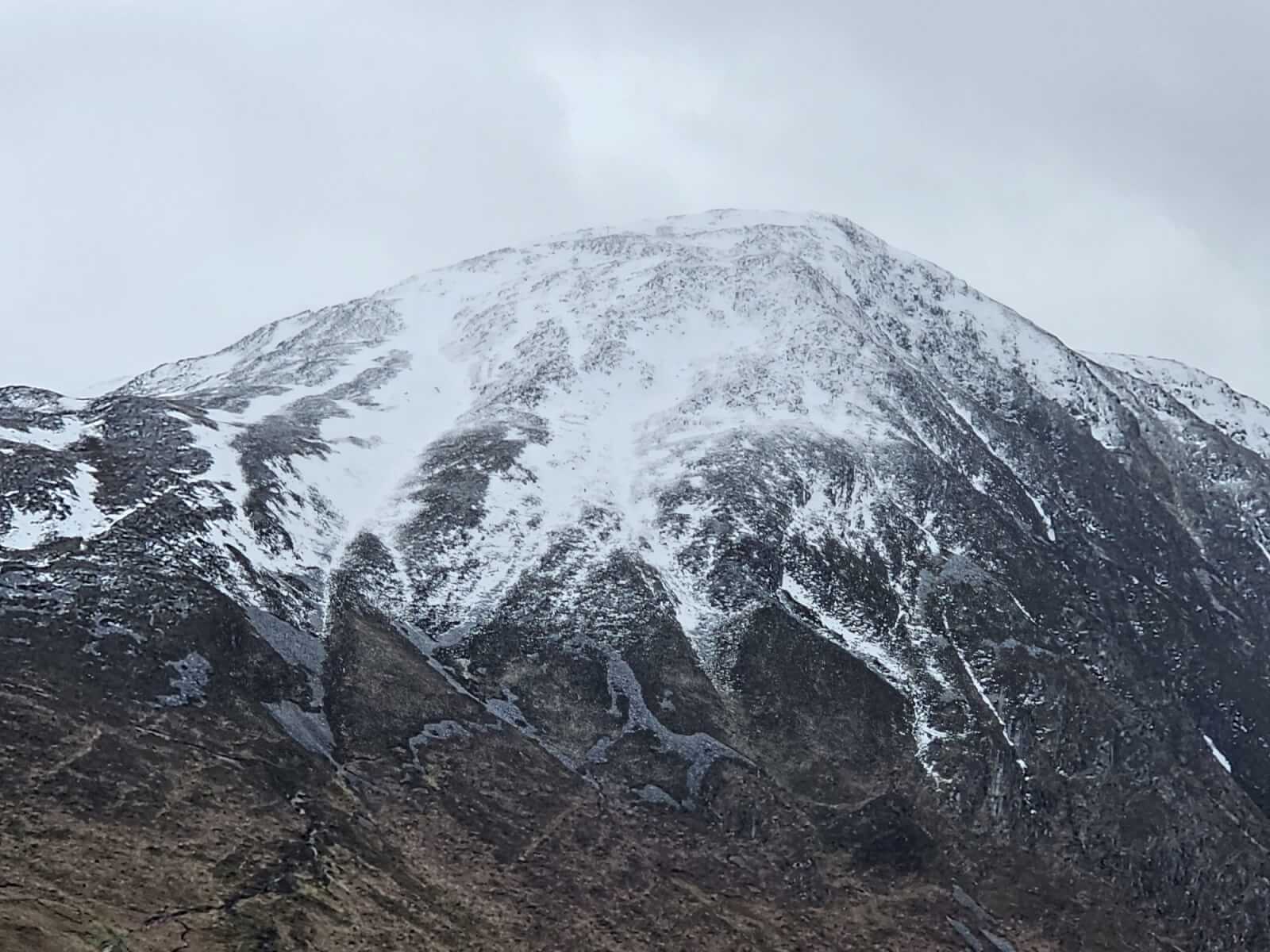
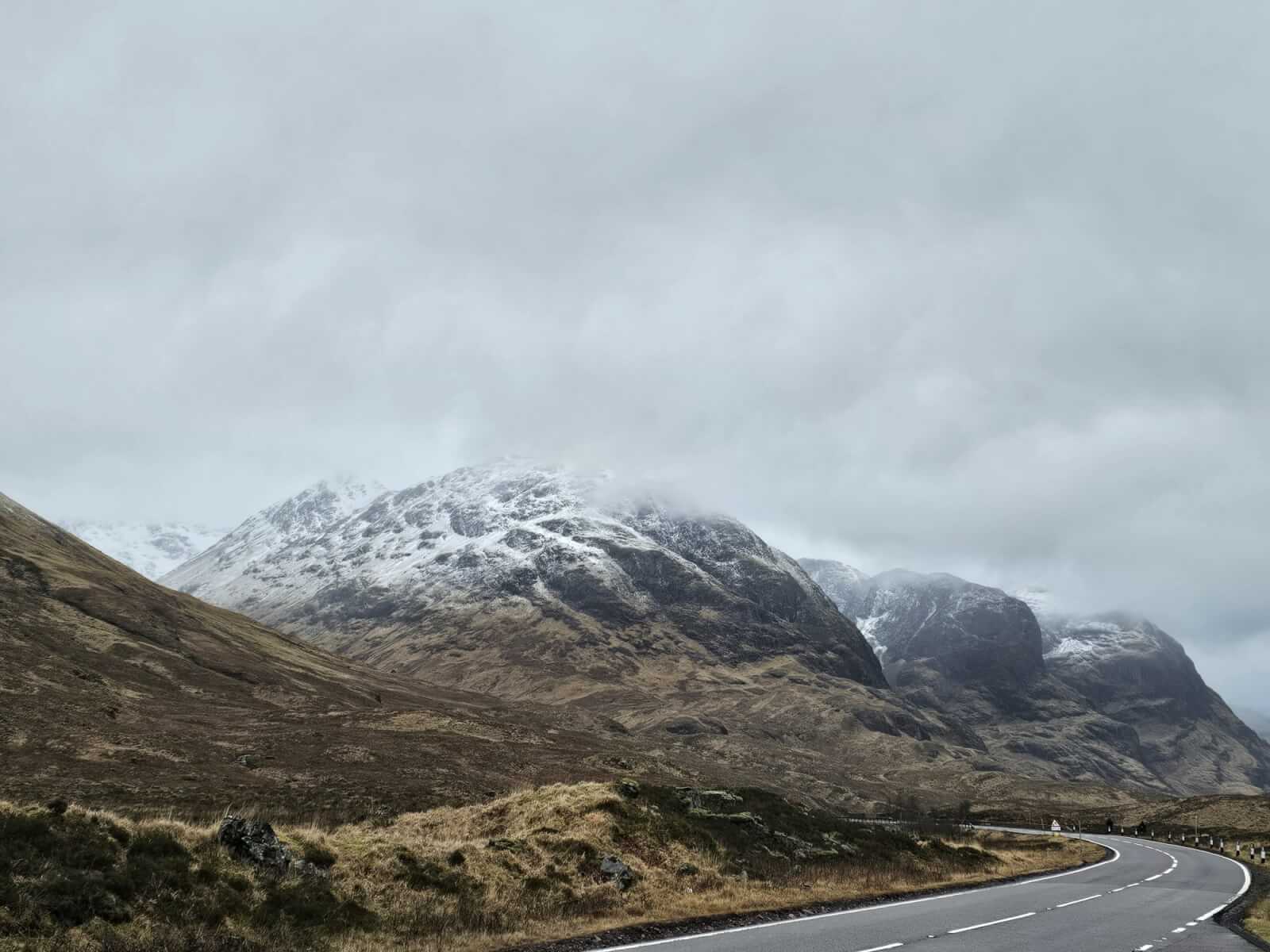
Sgorr nam Fiannaidh this morning before the low cloud settled in.
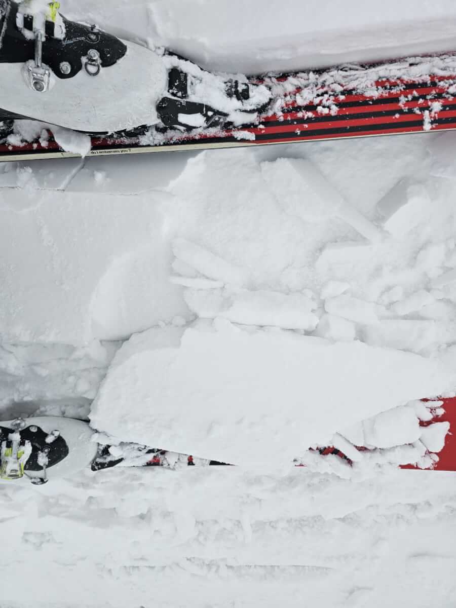
Shallow soft windslab on an icy layer breaking away under skis, here on Meall a Bhuiridh, north-east aspect at 900 metres.
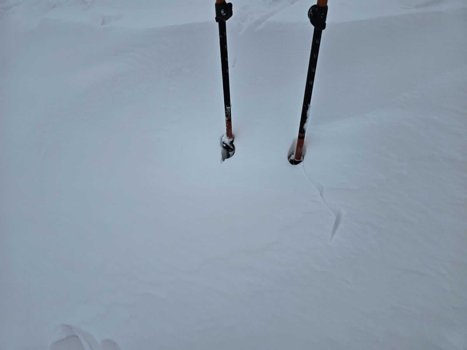
Some deeper accumulations.
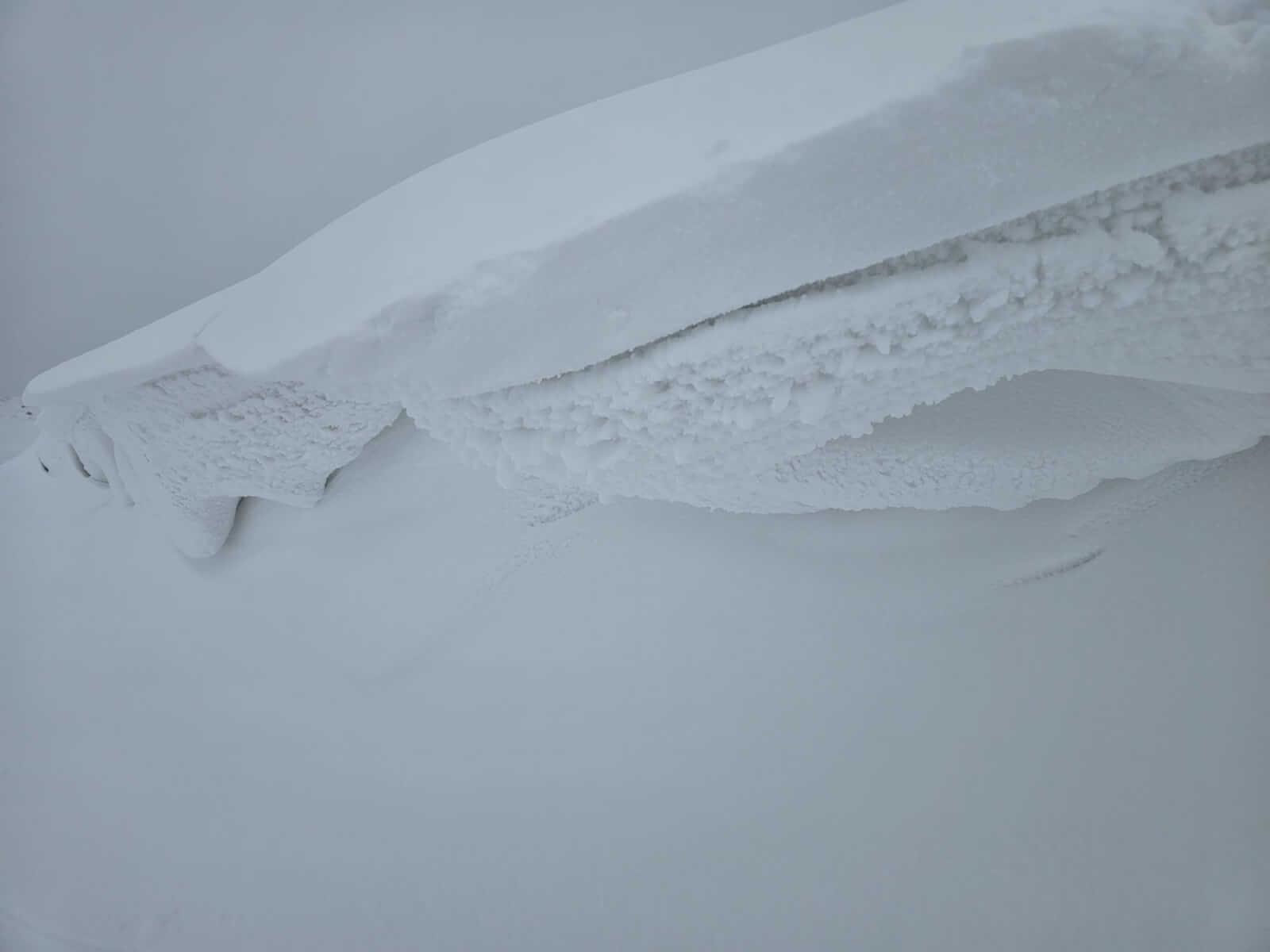
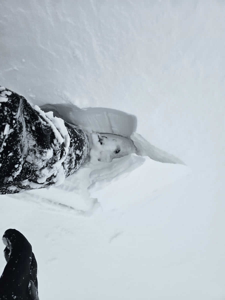
Cornices with fresh accumulations, easily collapsing under load.
Breaking through a thin crust into older windslab.
Not really a day for photos.
Comments on this post
Got something to say? Leave a comment