Where’s Winter, when is it coming back and what’s a Rossby wave ?
11th February 2023
The remaining snowpack is well bonded, stable, and unfortunately, diminishing in the current mild conditions. The following pictures of Glencoe attest to this.

The three sisters looking a bit gloomy this morning.

The snow continues to escape the hill !
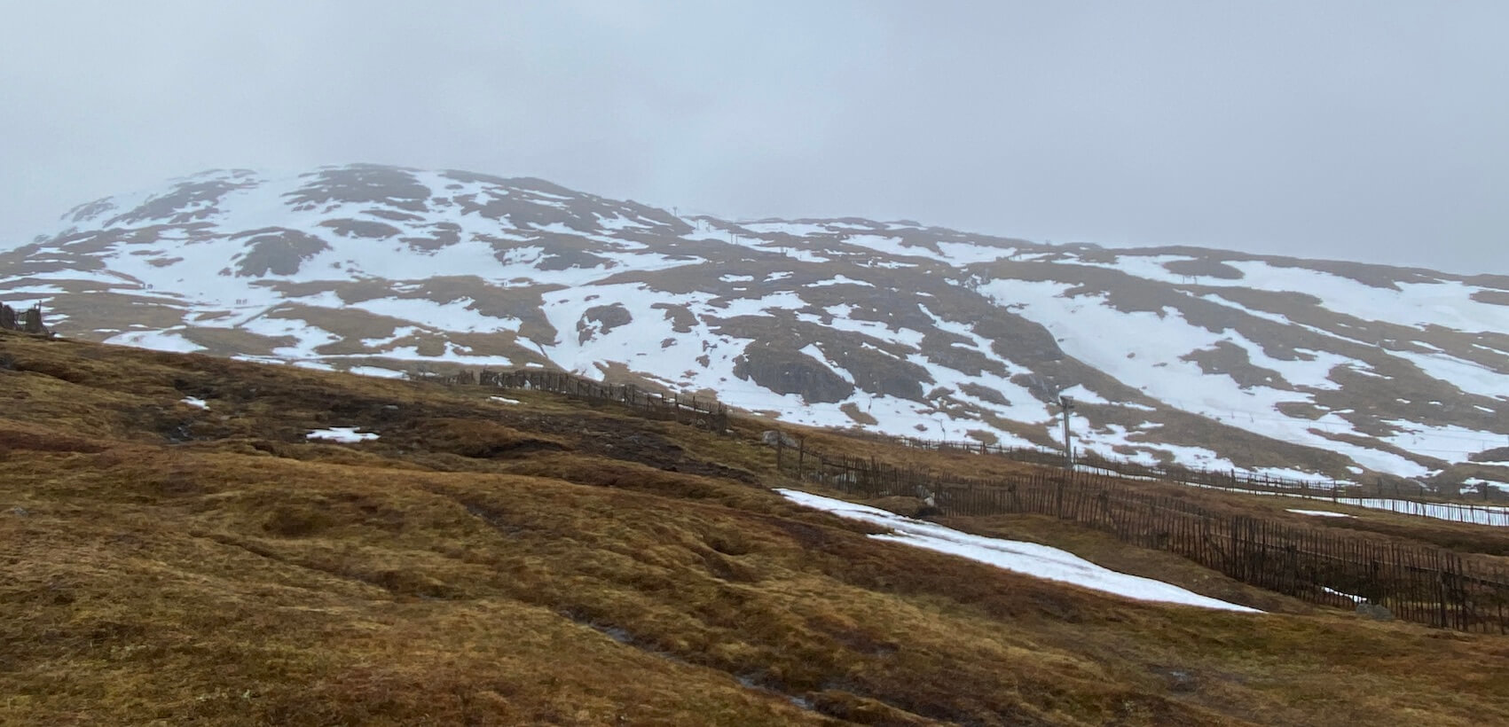
The remaining cover on Meall a Bhuirdh
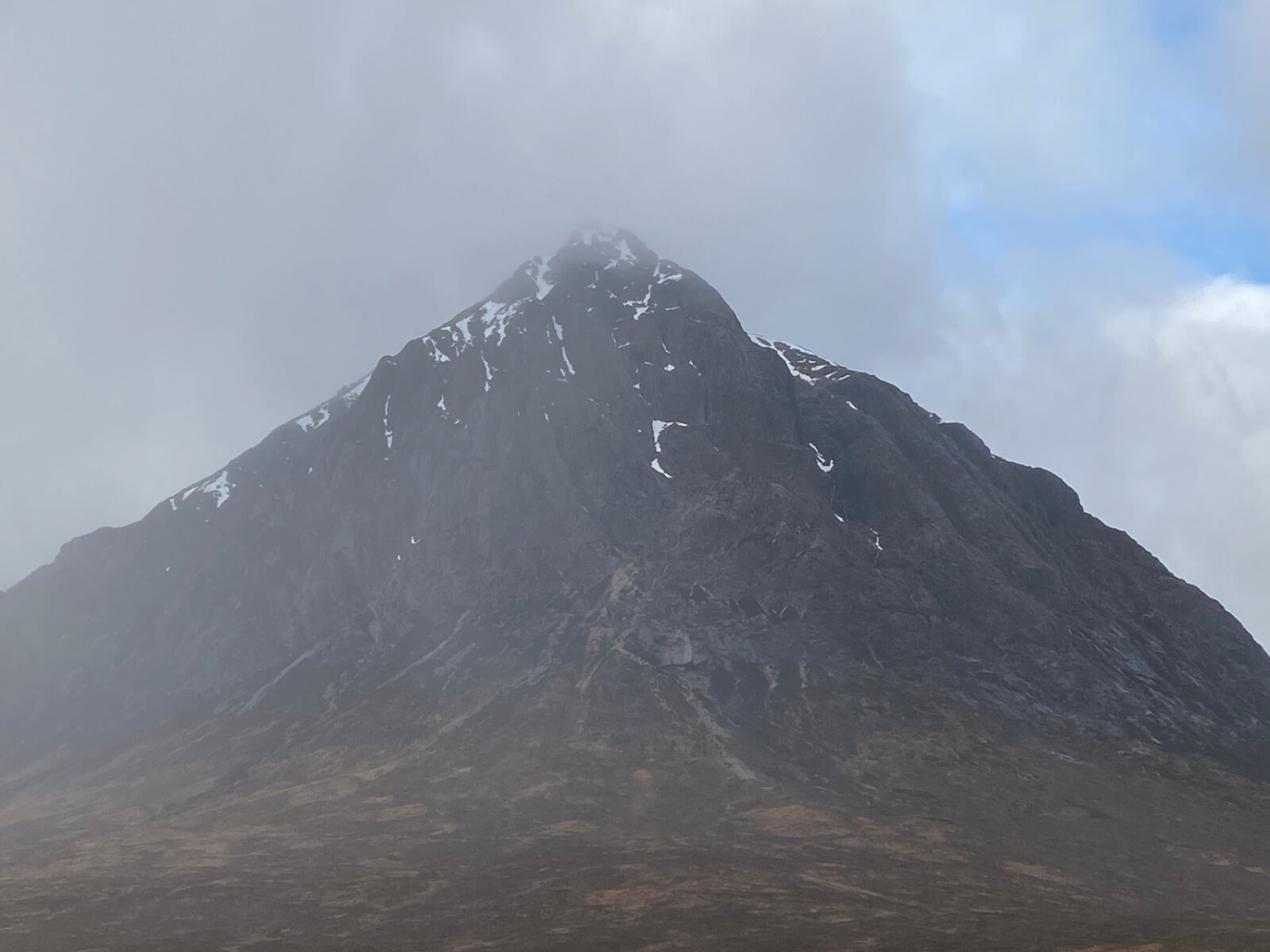
Stob Dearg looking pretty bare.
So… when might it come back, and what’s a Rossby wave ?
Well, to try and look at why we are sitting in mild air at the moment, it’s handy to know a little about Hadley Cells, and Rossby waves. The UK sits on the border of the Polar Hadley Cell and the Mid Latitude Hadley Cell. This interface is called the Polar Front.

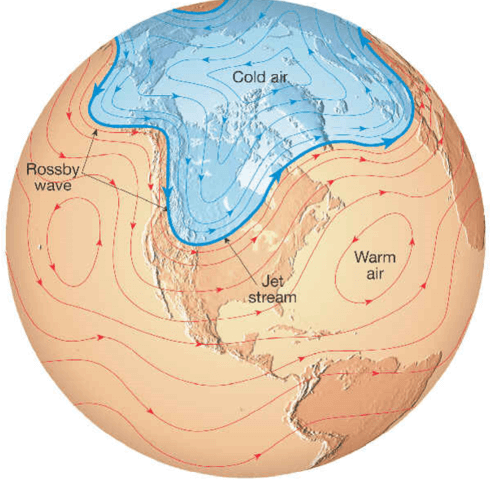
The Northern Hemisphere Hadley Cells.
Usually in the Northern hemisphere Winter, the Polar cell gets larger as the North Pole cools, and the Polar front sinks South. This puts the UK more in the colder Polar Cell air, hence colder weather. However, global warming seems to be leading to this effect being less noticeable or reliable in the Winter.
In addition to this, there are waves in the Polar front called Rossby waves, which rotate around the earth. These waves also affect whether we are sitting in warm air, or colder air.

A Rossby wave in the Polar front. Normally there are several of these waves around the globe.
Looking down on the Polar front and Rossby waves, here there are 5 waves shown. The UK sitting in the cold air from one of them.
So, there are some mid term weather forecasts that illustrate the predicted movement of both the Polar front, and Rossby waves, which can help try to predict when it will get colder, and Winter may return. One such forecast is shown here:
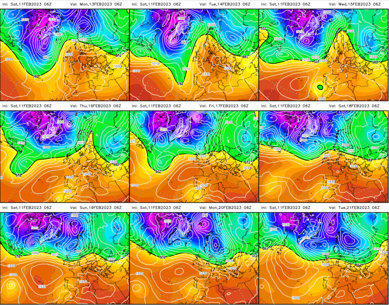
A mid term forecast looking at the Polar front and Rossby wave positioning, showing the warmer and colder air.
This forecast is predicting that we will sit on the border of the Front for the next week, giving occasional slightly cooler temperatures, but not by much. It is certainly predicting that we will stay mild until Wednesday, as we sit in the warmer air. No sign of any large Rossby waves, or significantly colder conditions.
There is a slight indication that we may start to sit in colder air come next Sunday.. But then again, it’s all just a forecast !
Comments on this post
Got something to say? Leave a comment


Jon Eden
11th February 2023 6:57 pm
Very interesting article, thank you. I have two days booked with WCMG on 21st/22nd February. I’ve been looking in recently and it doesn’t look great. I’m not expecting so much. In 2010 I climbed on Steal Falls with WCMG. What a difference. Am I right in thinking 2020/2021 was good when we were all in lock down?
Allan Crawford
11th February 2023 8:29 pm
I am surprised how fast the snow has melted given how much snow was on the hills about a month ago, thought we were set for a decent winter.